Software Development
Across various roles, I have developed code in Python, MATLAB, NCL, Fortran, and other languages for various weather and climate applications including processing and analyzing data in NetCDF, Grib, CSV, and various other formats. For examples of my work, see below.
Python Libraries for Atmospheric Science Research
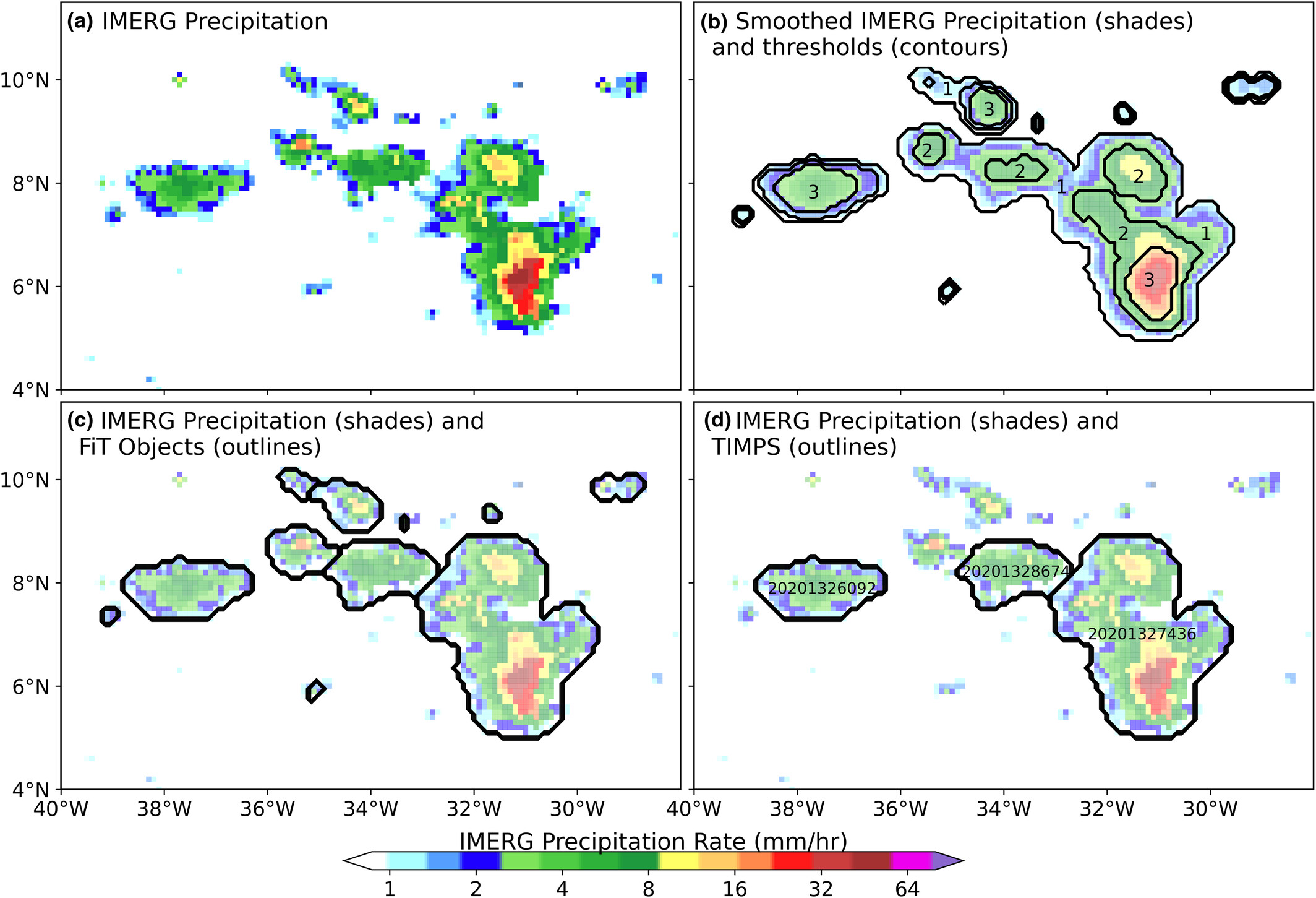
During work with NASA, I developed a library of Python-based code to build a data set of tracked precipitation features from a global satellite-derived precipitation data set. The code is published in Github, data set published in Zenodo, and the work is published in the Geoscience Data Journal and JGR: Atmospheres.
Over a number of years, I have also built a Python library of Python functions for atmospheric science data analysis for use in a variety of research applications.
The graphic shows a depiction of a number of tracked precipitation features from the data set above. It also shows a graph depicting the calculation of the area, volumetric rain rate, and lifetime stage of those precipitation features, developed with code from the atmospheric science functions described.
Google Colab Notebooks for Meteorological Data Gathering and Visualization
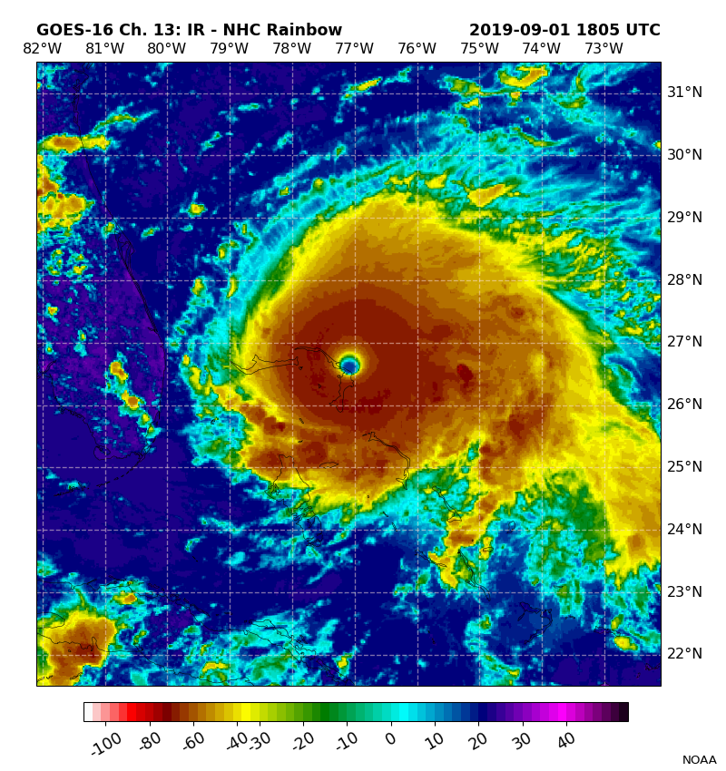
I have also developed a library of Google Colab-based Python notebooks that can download a plethora of publicly available observational (e.g. satellite and radar) and model forecast data (e.g. GFS and HRRR), and visualize those data on maps and soundings. An example is included where I developed a script that produces tropical GOES imagery centered on a tropical cyclone given the date and time and storm name.